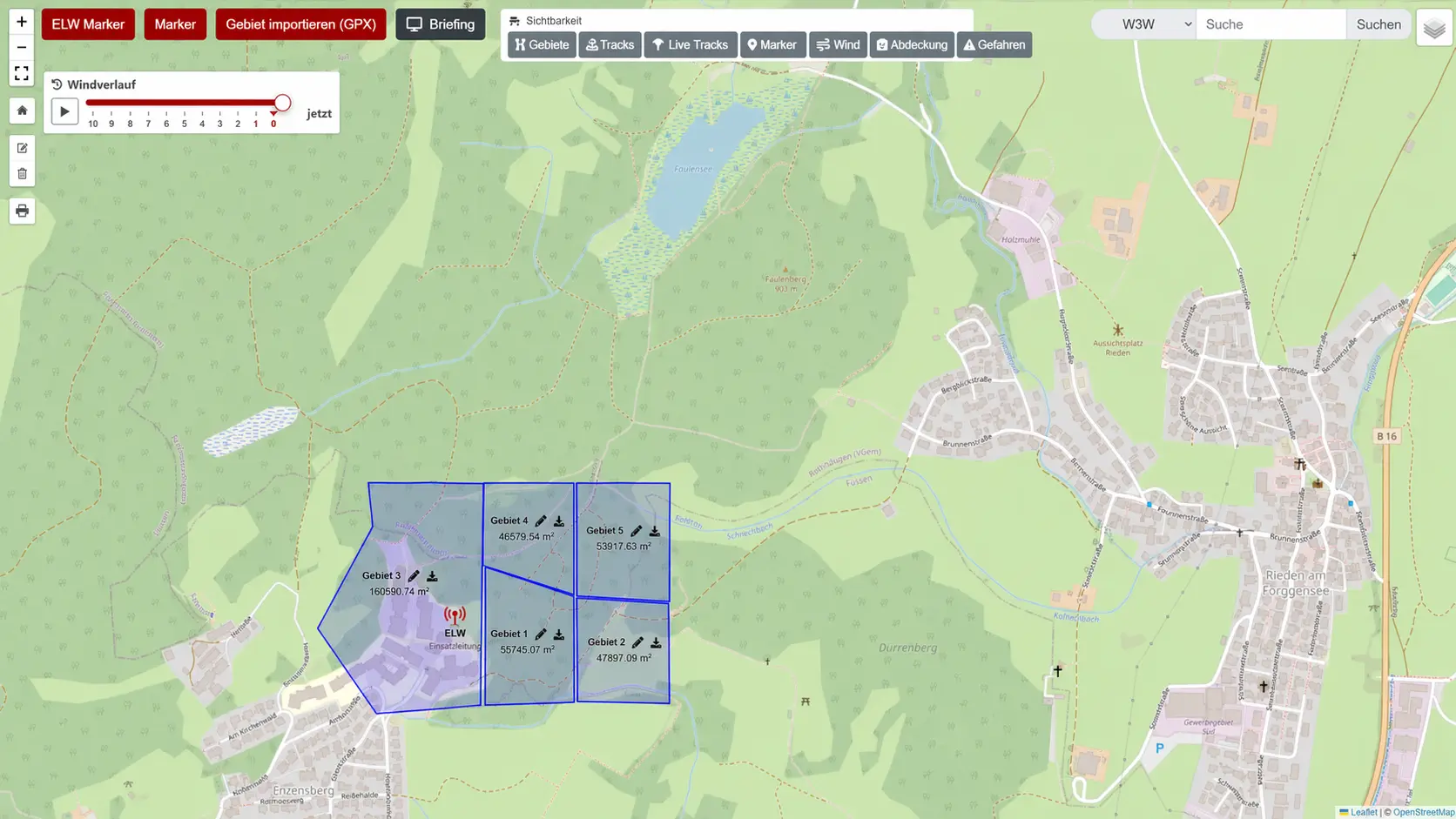
For area, rubble, avalanche and cadaver search, RescueDogs provides planning and recording tools. Teams can draw areas, mark persons and important points, share areas, import GPX data and analyze searches later.
Prepare search areas
The planner helps find the right location, draw and save an area. Location search, coordinate search and 3-word addresses help the team get to the right map section quickly.
Draw
Corner points, lines and area details make assignments clearer.
Import
GPX files can be used as search areas or additional tracks.
Markers
Persons, situation points and special places stay documented.
Share
Organizations can reuse areas together.
Map work for search dog teams
Different map layouts, terrain views and contour lines help assess paths and terrain. In the mission map, active teams, tracks, weather, wind and markers come together.
Review after training or mission
Recordings can be opened, rated and commented. Several searches can be displayed together to review coverage, development and search behavior.
Turn areas into clear search assignments.
Use search areas for preparation, missions, training, analysis and documentation.